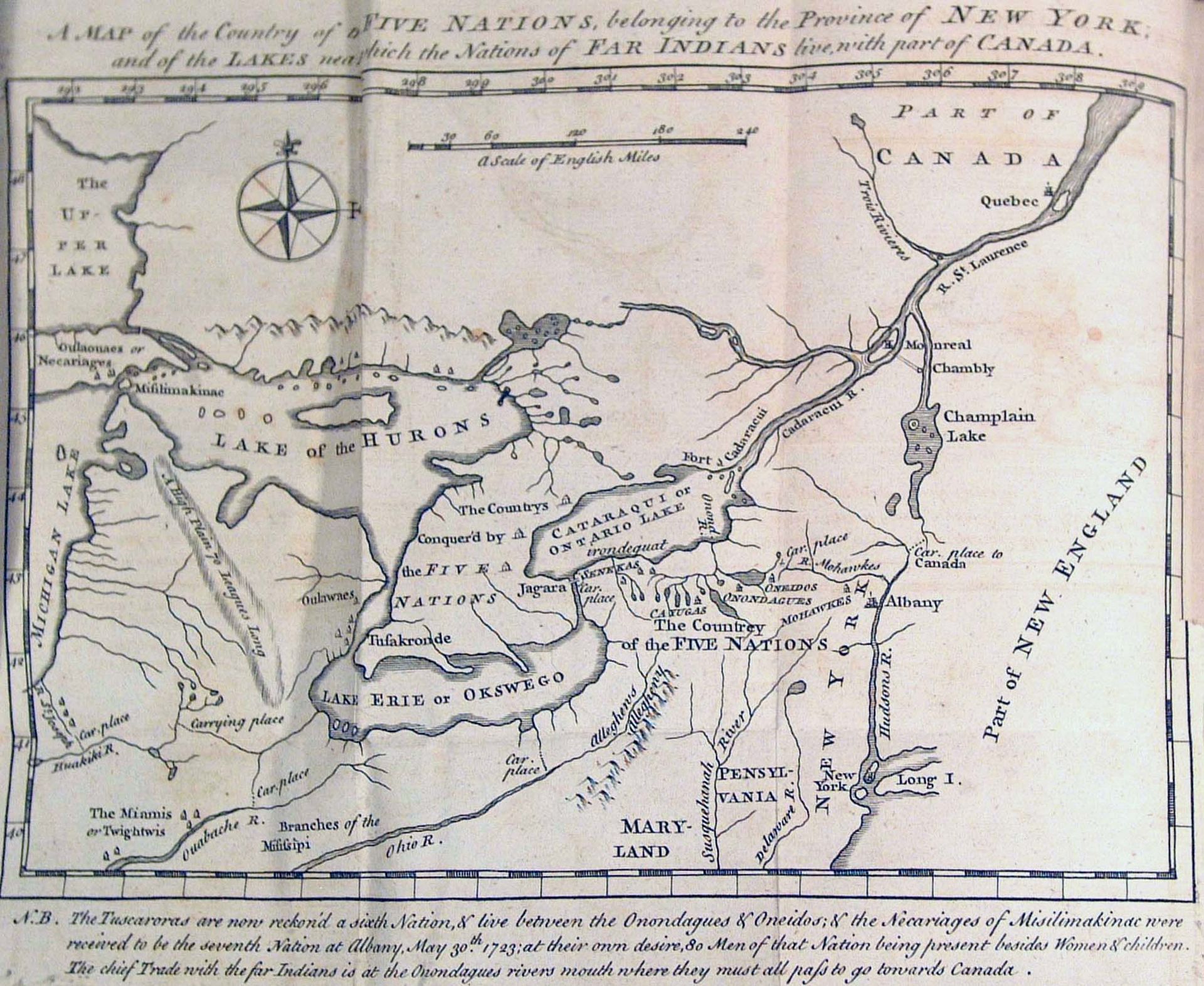
1787
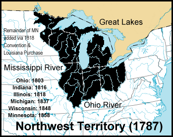
Congress created the Northwest Territory, Connecticut "reserved" for itself a portion of northern Ohio which became known as the western Reserve.
1792
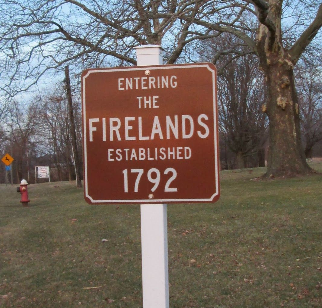
Connecticut assigned 500,000 acres at the western end of the Reserve to people in towns that had suffered losses from being burned out by the British during the Revolutionary War.
1795
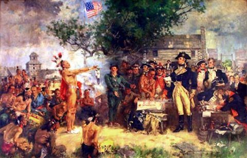
The Treaty of Greenville followed the defeat of Native Americans at the Battle of Fallen Timbers, resulting in the removal of most Indegionous Tribes from Northwest Ohio.
1812
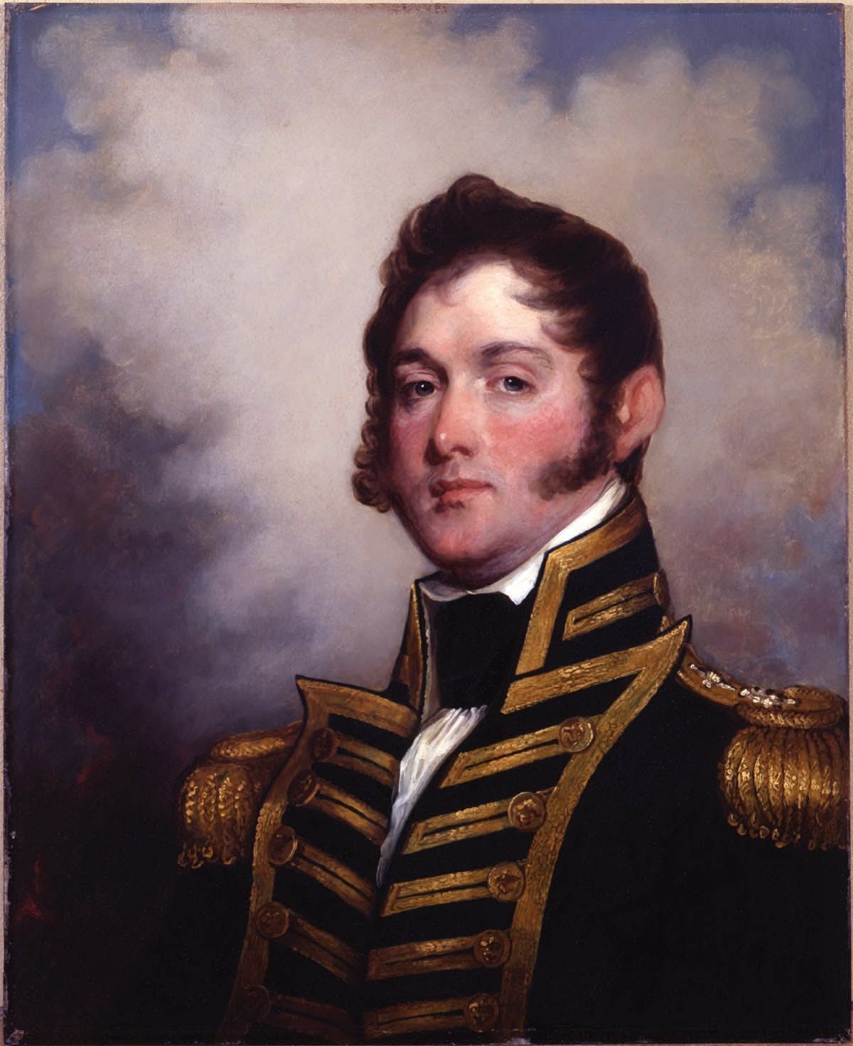
During the War of 1812, the Battle of Lake Erie was fought in the vicinity of Put-in-Bay. Under the command of Commodore Perry the fleet defeated the British in 1813.
1812
Afterwards he sent his report to William Henry Harrison: “We have met the enemy and they are ours, two ships, two brigs, one schooner, and one sloop.”
1830
Bay Township was organized when it was still a part of Sandusky County.
1831
The Native Americans were forcibly removed by the Ohio government to Kansas
1835
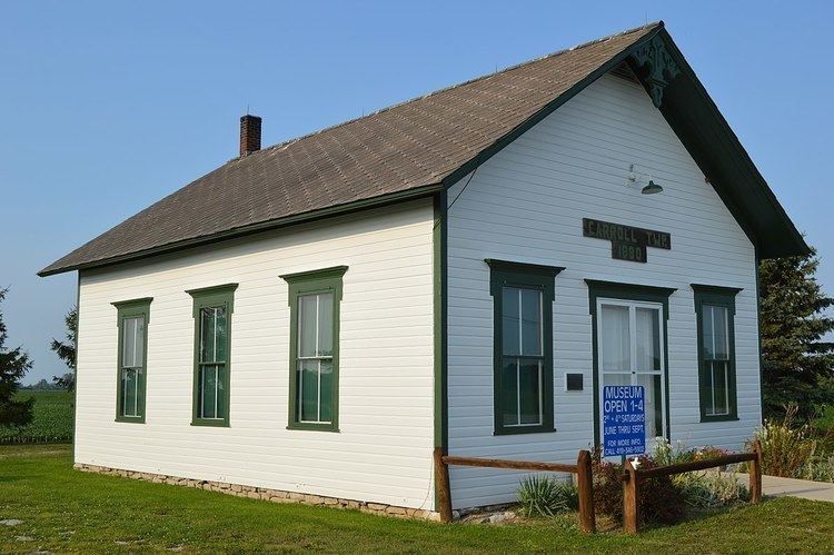
Carroll township formed, named Carroll while still part of Sandusky County.
1838
Catawba Island (originally called “Van
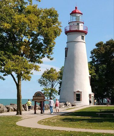
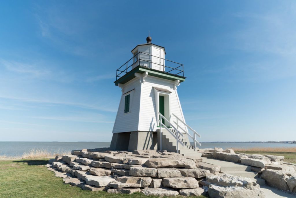
Rensselaer”) was founded.The guiding lights of the region—history, architecture, and stories of the county's historic lighthouses.
Rensselaer”) was founded.The guiding lights of the region—history, architecture, and stories of the county's historic lighthouses.
1839
Salem Township was formed.
1839
The County has a rich agricultural heritage—draining of the Great Black Swamp for farm fields, harvesting of oak trees in Oak Harbor and the western part of the county, and present day cultivating of farms, orchards, and vineyards. Farm artifacts on display depict this heritage.
1840s
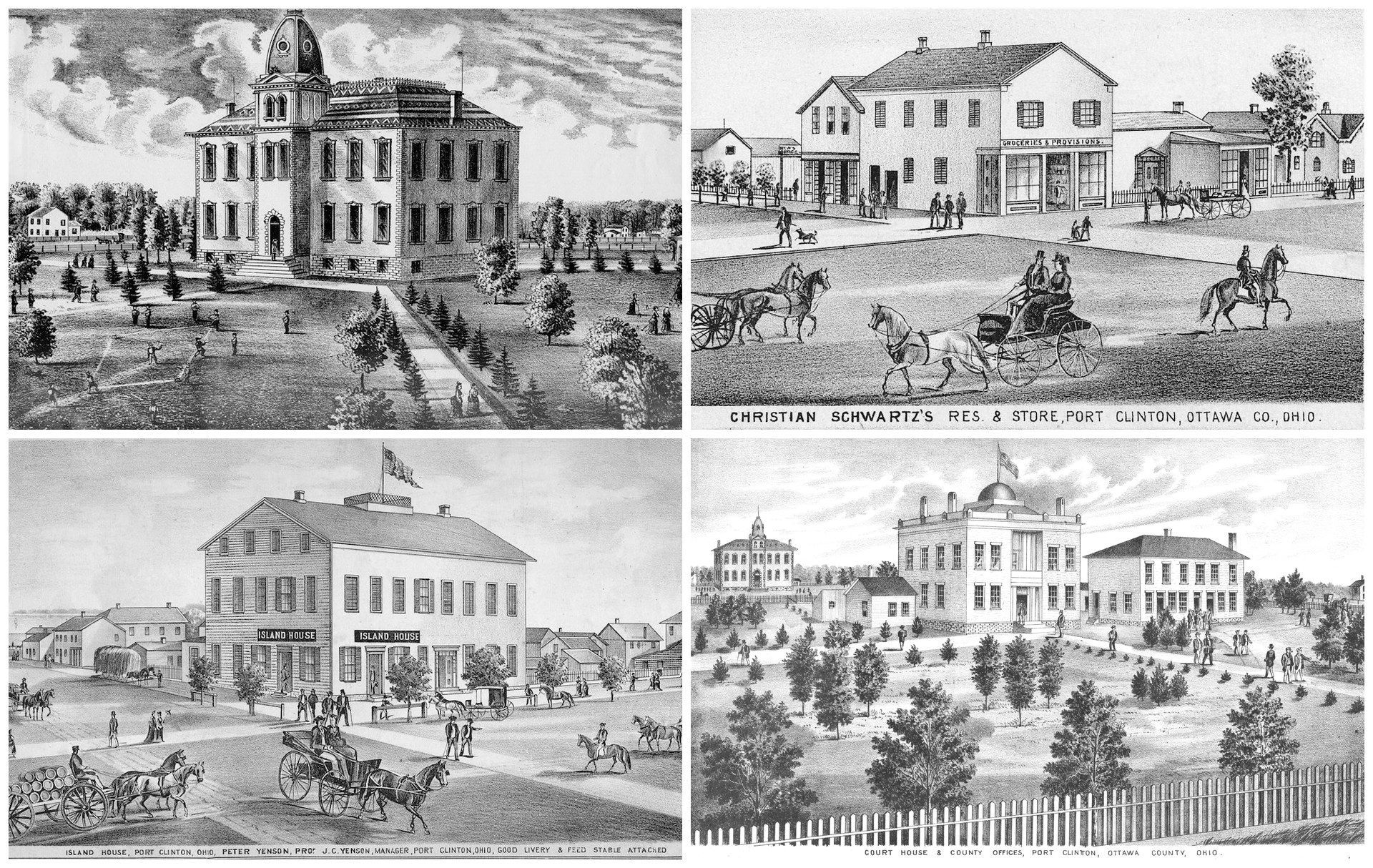
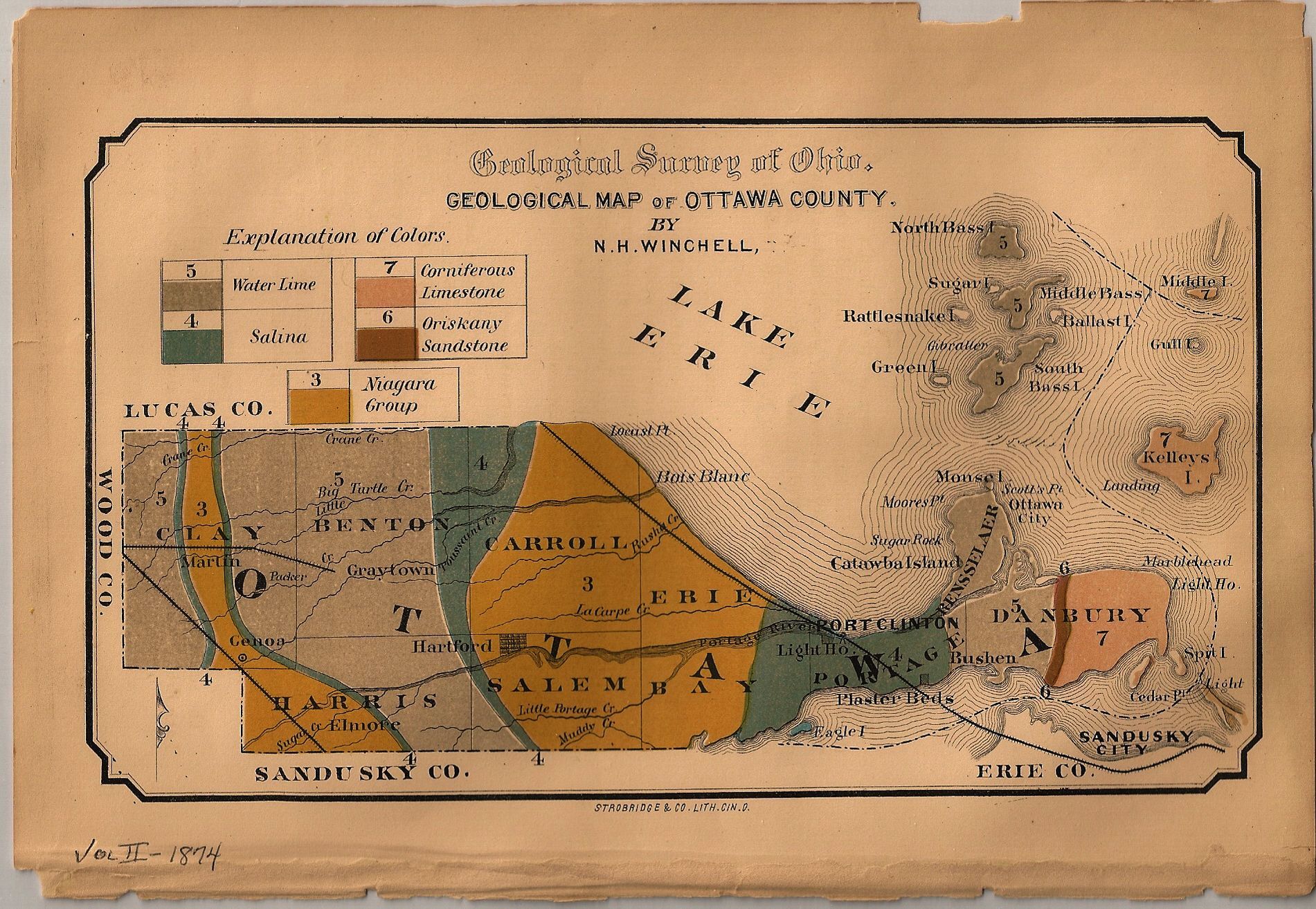
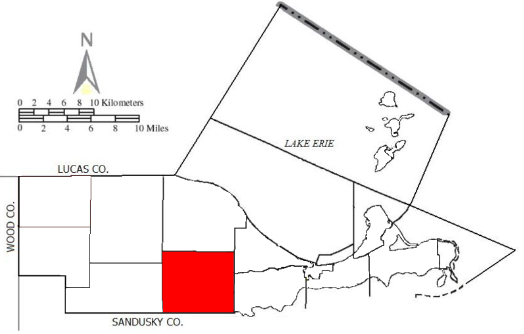
The county was organized March 6, 1840. The county seat is Port Clinton, located on Lake Erie at the mouth of the Portage River.
1840s
It received its name, Ottawa, after an Algonquin tribe of Native Americans inhabiting this section of the state previous to and at the time of the first settlements made by the whites. The word “Ottawa” means trader in the English language. The General Assembly of Ohio established Ottawa County to be formed out of the north part of Sandusky and Erie counties and the eastern part of Lucas County.
The county originally contained an area of 163,340 acres or 255.25 square miles. When pioneer settlers came here to subdue the wilderness, much of the western portion of the county was partially covered with water and formed a part of what was then known as the “Black Swamp.” A small section of the eastern part of the county was known as the “Firelands,” which were donated by the state of Connecticut to persons who were made destitute by the burning of their property by the English during the Revolutionary War.
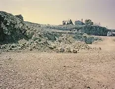
Large portions of the county’s marsh land have produced heavy crops or wheat, corn, soy beans, corn, potatoes, and onions. The eastern portion is better adapted to grow fruit, especially peaches and grapes, though the west end has many fine orchards. Limestone is found in abundance throughout the county. Limestone is found in abundance and mines are found in Marblehead, Genoa, Rocky Ridge, Limestone, Williston, and Clay Center. Gypsum is found in large quantities near the town of Gypsum. Fishing is a prominent industry and among the foremost in the state.
The county originally contained an area of 163,340 acres or 255.25 square miles. When pioneer settlers came here to subdue the wilderness, much of the western portion of the county was partially covered with water and formed a part of what was then known as the “Black Swamp.” A small section of the eastern part of the county was known as the “Firelands,” which were donated by the state of Connecticut to persons who were made destitute by the burning of their property by the English during the Revolutionary War.
Large portions of the county’s marsh land have produced heavy crops or wheat, corn, soy beans, corn, potatoes, and onions. The eastern portion is better adapted to grow fruit, especially peaches and grapes, though the west end has many fine orchards. Limestone is found in abundance throughout the county. Limestone is found in abundance and mines are found in Marblehead, Genoa, Rocky Ridge, Limestone, Williston, and Clay Center. Gypsum is found in large quantities near the town of Gypsum. Fishing is a prominent industry and among the foremost in the state.
1840s Cont'd
Clay Township separated from Sandusky County.
1844
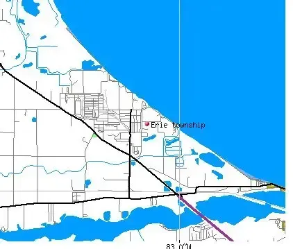
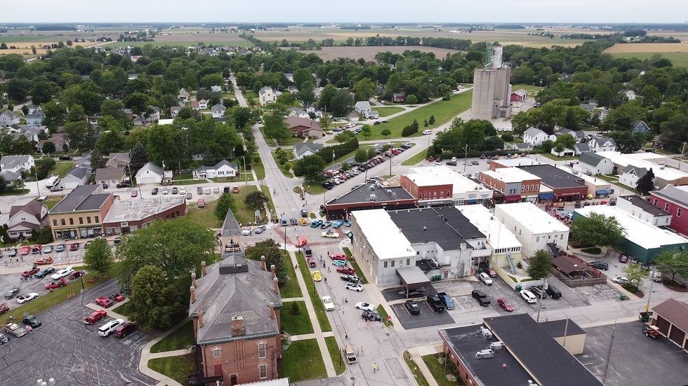
Erie Township formed.
1850

Benton Township formed.
1852
Portage Township formed. Port Clinton incorporated from part of Portage Township.
1861

Danbury Township formed.
1870
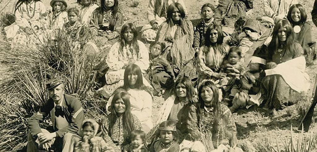
The Native Americans were forcibly removed again to modern day Kansas.
1888
Allen Township formed.
1913
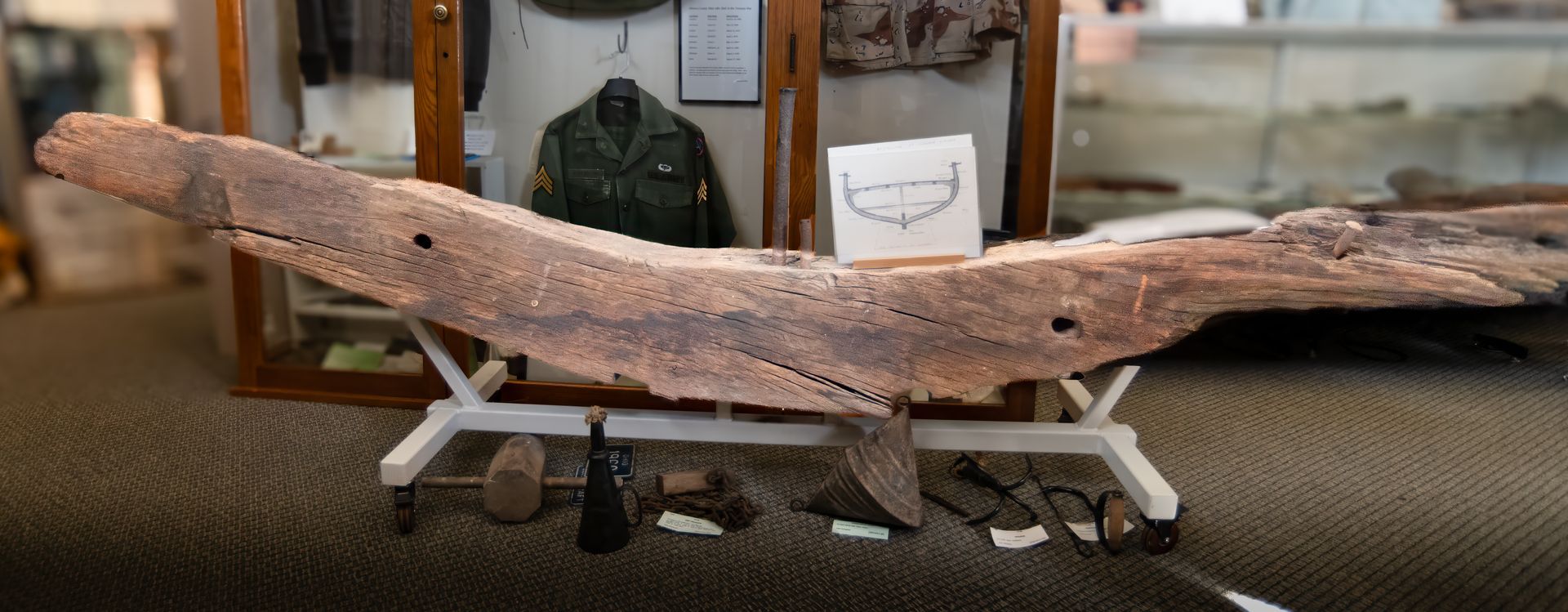
A timber from Perry’s ship was recovered and is now exhibited at the OCM.
1976
Put-in-Bay village incorporated.